

Before the Doors Open: What Aerial Perspective Reveals About Commercial Growth
One of the gifts of living in a growing North Texas community is getting to witness places before they become familiar.
Fields become foundations. Roads carry new patterns. What once felt open begins to take shape. Over time, we stop noticing the transition. It simply becomes where we go.
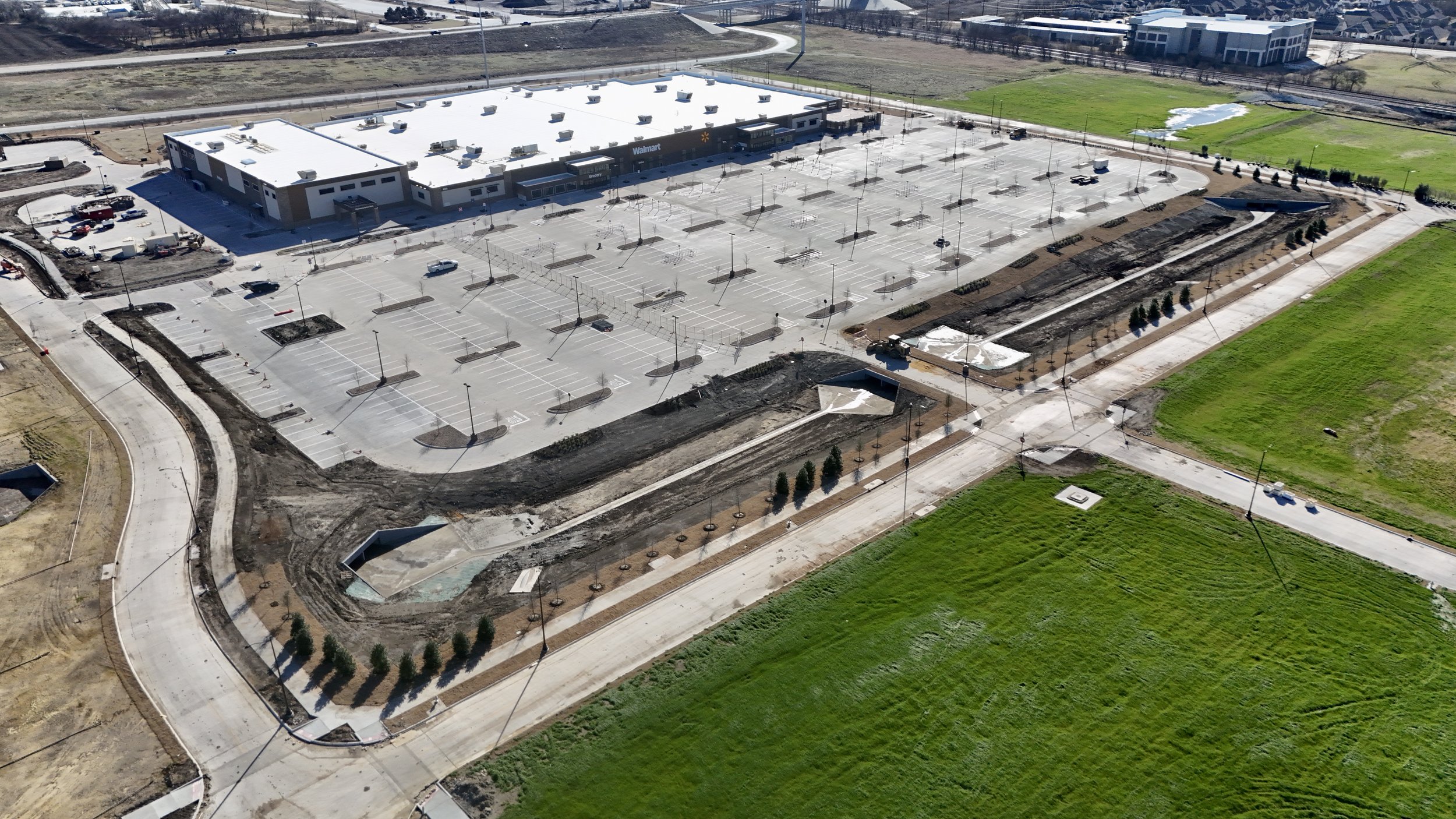
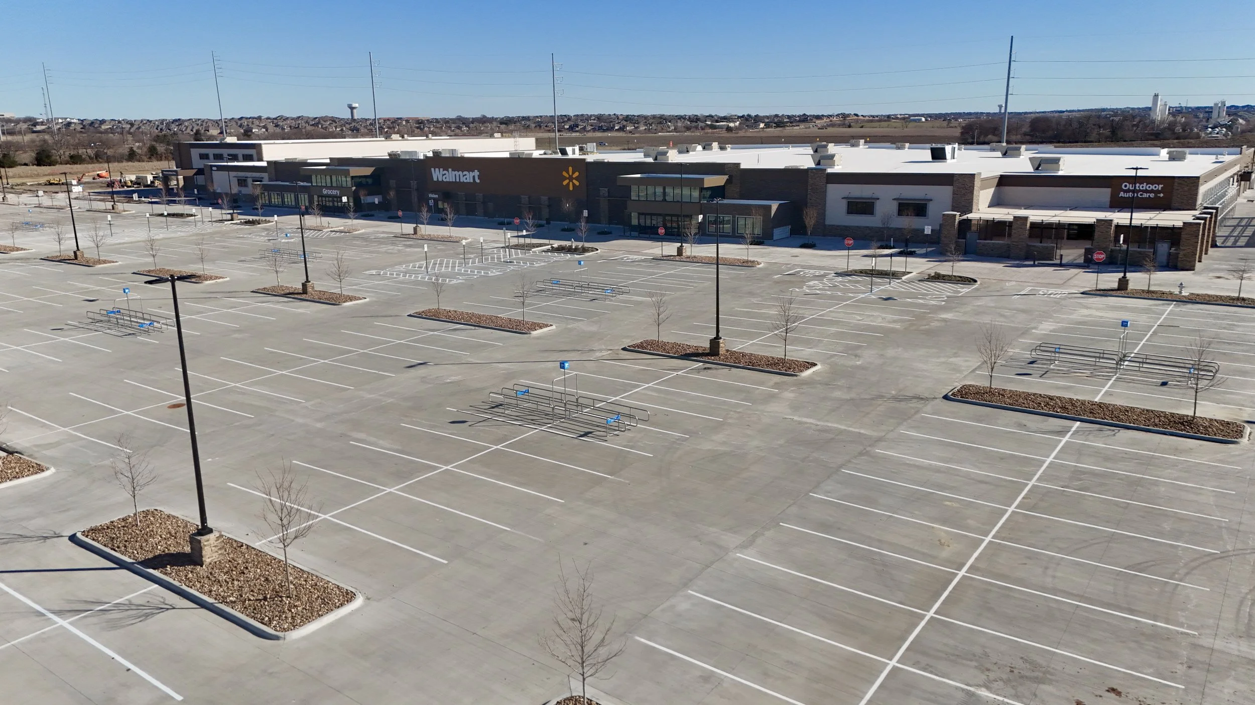
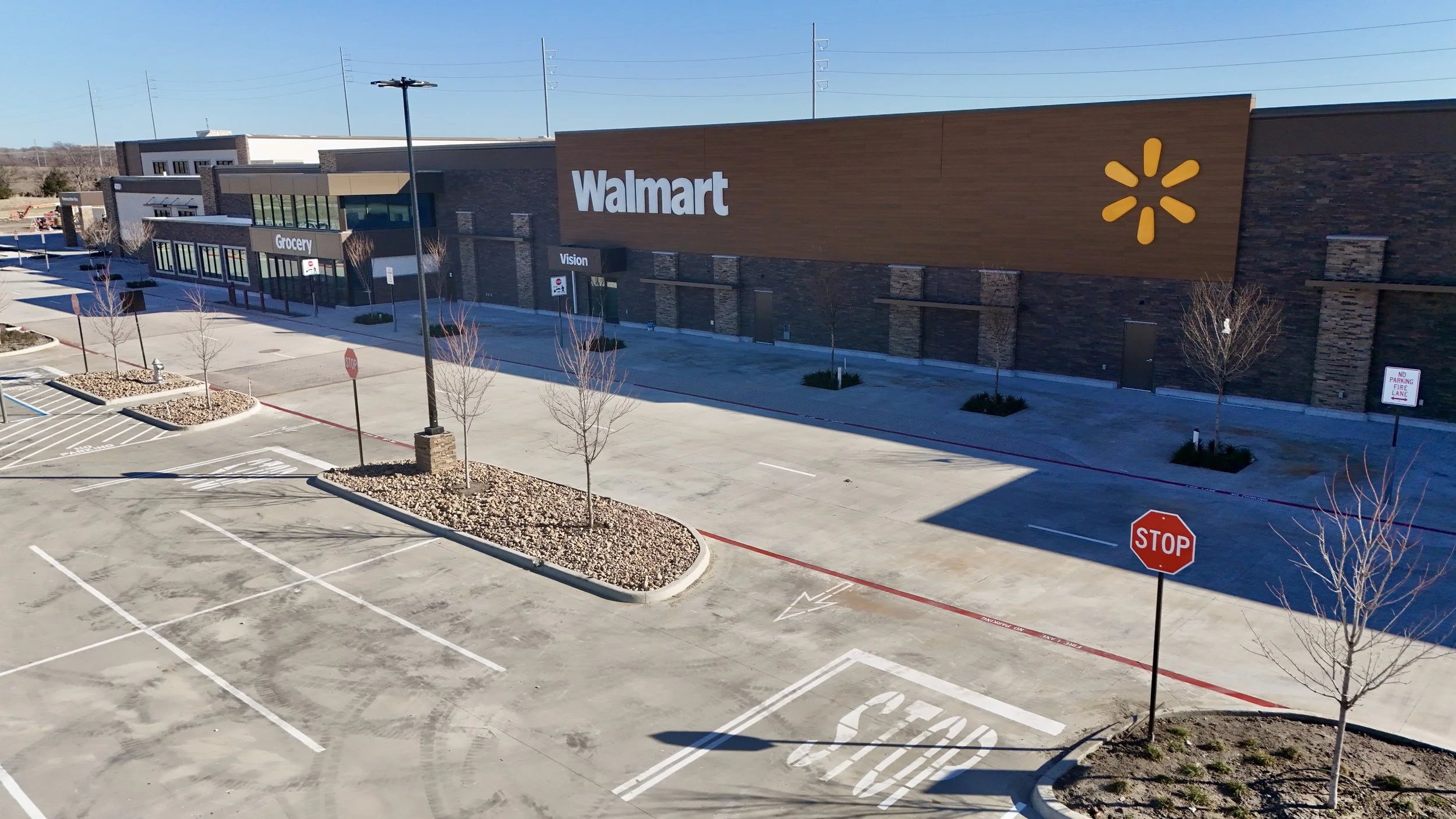
Last week, I toured the new Walmart under construction in Celina. Even unfinished, the intention was clear. The scale, the layout, the movement flow. This store is being designed for how people shop today. Thoughtful. Efficient. Future-facing.
I found myself unexpectedly excited.
Maybe that is the innovation part of me. Or maybe it is simply the storyteller. Growth always carries anticipation, and in Celina, commercial expansion feels personal because it reshapes daily life.
So I did what I usually do in moments like this.
I flew the drone.
I wanted to remember what this site looked like before the doors opened. Fresh signage and no traffic. Before routine replaced curiosity.
From the ground, you see construction. From above, you understand context.
Seeing what the ground cannot
Standing on a job site gives you fragments. Walls. Equipment. Activity. It is difficult to grasp how a place truly sits within its surroundings.
Aerial perspective reveals relationships.
Road access. Neighborhood proximity. Visibility. Adjacent land. Future growth paths. These are the factors that determine whether a commercial location functions well over time.
When I reviewed the footage from above, something else stood out.
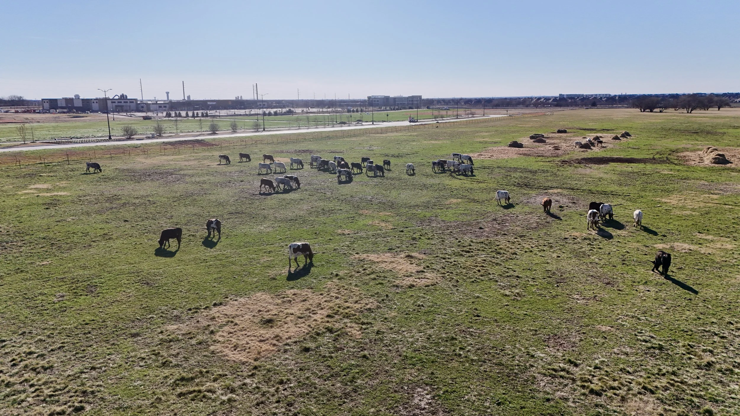
Every approach to the site included a view of longhorns grazing nearby.
It felt unmistakably Celina. Modern retail rising beside heritage Texas landscape. Growth and roots sharing the same horizon.
From the air, that coexistence becomes clear in a single frame. The development is no longer just a store. It is part of a place story.
That is the difference context makes.
More than marketing imagery
Drone services in commercial real estate are often associated with marketing visuals. Aerial imagery does communicate scale and location clearly. It helps developers present projects and helps communities visualize change. Commercial sites like these often change quickly, which is why aerial documentation can help stakeholders see progress with clarity over time.
But its value begins earlier.
Aerial context supports site selection and investment decisions. It allows teams to evaluate how a location is experienced, not just mapped. Visibility from approach routes. Relationship to surrounding neighborhoods. Compatibility with adjacent land. Potential for future growth around it.
These spatial relationships shape long-term viability.
In fast-growing North Texas markets, land can shift quickly from rural to suburban to commercial. Perspective helps decision-makers understand not only what a site is today, but how it lives within what is coming next.
Preserving the moment before routine
One of my favorite parts of drone storytelling is documenting construction progress. Returning to the same site over time reveals transformation in stages. Grading. Structure. Completion. Opening.
Each aerial pass becomes a record of becoming.
For businesses, these visuals track progress. For communities, they preserve memory. We forget quickly what places looked like before they changed. Aerial imagery keeps that early chapter visible.
When I captured this site, I was not just documenting a building. I was recording Celina in transition, before this location simply becomes where people shop.
Perspective in leadership and growth
Commercial expansion decisions often rely on data, projections and planning models. All necessary.
But leadership also requires understanding lived experience. How will people encounter this place? What will they see first? How does it fit within the identity of the community it enters?
Businesses that align with place context integrate naturally into daily life. They feel located, not inserted. In regions like North Texas, where growth is constant, that alignment matters. Growth stories are unfolding in ways that deserve to be documented intentionally.
Aerial storytelling helps leaders see that relationship clearly. Development, environment and community visible in one view.
A moment worth remembering
What I will likely remember most about this site is not the structure.
It is the longhorns grazing beside a future retail center.
That image holds something true about Celina. Growth is happening. New businesses are arriving. And still, the land carries memory.
That coexistence reflects communities trying to grow without losing themselves.
As I flew above the site, I was reminded why documenting commercial development from the air matters to me.
Because before a place becomes routine, it is possibility.
Before doors open, it is anticipation.
Before familiarity settles in, it is story. For developers and community leaders, this perspective often becomes part of how projects are shared, remembered and understood.
And some moments are worth capturing while they are still becoming.